
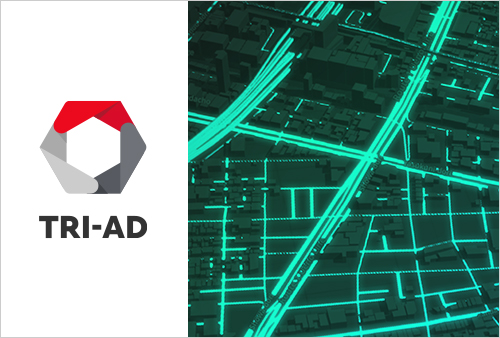
Maxar Technologies (“Maxar”), a trusted partner and innovator in Earth Intelligence and Space Infrastructure, Japan’s leading IT services provider NTT DATA Corporation (“NTT DATA”), and TRI-AD are collaborating on a proof of concept to build automated HD maps for automated vehicles using the highest-resolution commercial satellite imagery since April 25th, 2019. The PoC demonstrates it is now possible to automatically extract the required map information by analyzing and removing and correcting non-map image pixels such as automobiles, shadows, and occlusions due to the inclination of buildings in satellite imagery. Currently, maps with a relative accuracy of 25 centimeters*1 were created within the 23 wards in Tokyo, as well as 6 cities globally, and were verified to be useful for automated driving purposes. (Refer to Image 1, 2 and 3.)