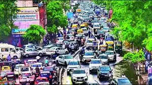
With the traffic department joining hands with a private mapping mobile application, commuters will get access to real-time updates on city traffic conditions.
Speaking to TOI, DCP traffic Sri Sagar said the department had signed a memorandum of understanding (MoU) with MapmyIndia app about two months ago. Along with real time traffic updates, the app also provides a comprehensive range of information, including speed limits on specific roads, black spots, traffic congestion, and potential diversions.
“Real-time information on traffic situations will empower commuters to organise their trips more effectively, circumventing congested areas and perilous routes. Once the app is downloaded on a mobile phone it will notify users about accident-prone zones, urging them to exercise heightened vigilance while navigating through these sections,” Sagar said.
Officials said the app’s most advantageous feature is its ability to provide real-time updates on road closures and suggested diversions, in addition to alerting users about traffic congestion.
TOI first reported this initiative by the Jaipur city police on June 14.
Traffic officials said the app will also display permanent information such as speed limits imposed on various city roads, the locations of speed cameras, and stretches where motorists must cross rail gates, underpasses, or railway overbridges.
The app will send constant alerts to motorists about speed breakers installed on city roads, potentially hazardous turns, and black spots identified by the department, providing warnings from approximately 200 to 300 metre before a motorist reaches the spot.
“We believe that such a facility will not only contribute to reducing the number of accidents on city roads but also make driving and riding on city roads more convenient,” Sagar added.

