Read by: 100 Industry Professionals
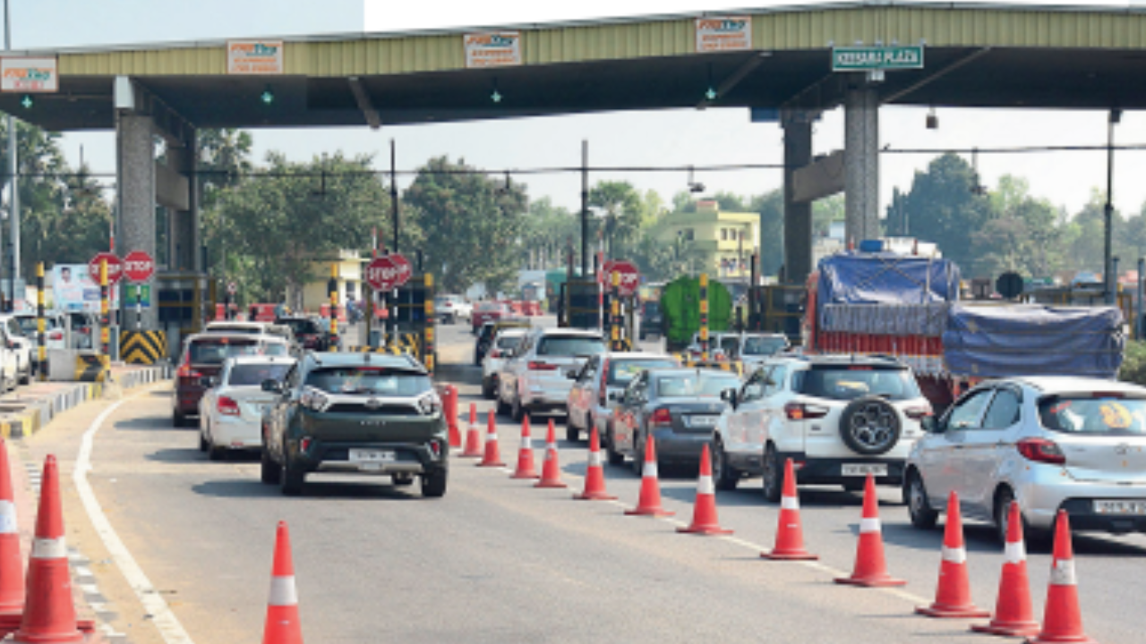
The govt this week set the ball rolling for toll collection based on Global Navigation Satellite System (GNSS) coupled with on-board units (OBUs) installed in vehicles. The new system, once fully operational across highways, will ensure nonstop travel and remove the need for physical toll plazas or toll gates. The full rollout will need a couple of years, but the system promises a better experience during highway travel. Here’s how it will work:
Satellites will track distance
The key highlight of the new toll system is that a satellite or constellation of satellites will track the movement of vehicles and calculate the toll or user fee based on the exact distance travelled. That means vehicles will no longer have to stop at barriers for the electronic deduction of toll. The road transport and highways ministry amended the NH Fee Rules to allow toll collection using the GNSS-OBU system earlier this week. Officials said the toll system will use NavIC, India’s satellite-based navigation system.
Using pre-installed device
Each vehicle will need to be fitted with a non-transferable GNSS-OBU unit. This unit, which works as a tracking device, can either be installed externally (retrofitted) or come installed from the factory. This unit will communicate digitally with a ‘centralised/zonal toll charger’ software that will be installed along designated highway stretches. This ‘toll charger’ will receive inputs regarding distance and time travelled from the OBU fitted in vehicles.
These OBUs will be onboarded with the ‘toll charger’ by fintech companies, which will serve as the “issuer entity”, just like there are issuer banks under the FASTag system. The installation of OBUs will be checked at the time of registration, re-registration and fitness test.
And virtual toll booths
Tracking of the entry and exit of vehicles will be done using virtual gantries (a kind of signal infrastructure) that are to be installed along the tolled highway network. These will communicate with GNSS-enabled vehicles. These gantries will thus serve as a virtual toll booth that will gather information such as vehicle registration number, type, and bank account details. When the GNSS-OBU vehicle passes through this virtual toll booth, the system will automatically deduct the user fee from the user’s account using the existing FASTag ecosystem for payment.
User fee will be calculated real-time whenever a vehicle crosses the designated length of toll plazas, makes a U-turn, and leaves the GNSS stretch. The user will get an SMS of the toll deducted on every occasion. The ‘toll charger’ will calculate the user fee based on toll parameters defined by NHAI such as type of structure, that is, bypass, expressway, or flyover, etc.
With dedicated lanes at first
To begin with, the existing toll plazas will have dedicated ‘GNSS lanes’ where the barrier gates will normally stay open to allow uninterrupted passage of vehicles fitted with GNSS-OBUs. These lanes will have the advanced readers to track such vehicles while allowing them to zip through without stopping. Subsequently, more lanes will be brought under this system.
NHAI will bring out the bid document in the next two months and the target is to make the first stretch under commercial satellite-based tolling operational by April-June 2025.
Indian and global technology majors, including TCS, Infosys, Accenture, RailTel, TCIL, Sky Toll, Kapsch, BEMobile and Movyon, have expressed interest and submitted applications to develop the system for GNSS-based tolling.
That will start with trucks
GNSS-based tolling will start with trucks, buses and vehicles carrying dangerous goods since these already feature the Vehicle Location Tracking (VLT) system and don’t involve privacy issues. Other commercial vehicles will be the next segment to be onboarded. Private vehicles will be brought under GNSS tracking as part of the last stage in 2026-27.
The highway-owning agencies of Central govt have completed the geo-fencing of almost the entire length of national highways. Geo-fencing is crucial for marking the exact entry and exit points for toll calculation. The GNSS tolling agency will do geo-referencing of highways before commencing GNSS-based tolling. The total length of national highways in India is around 1.4 lakh km with user fee being collected on approximately 45,000km.
Initially, GNSS-based tolling will be rolled out on 2,000km of national highways by June 2025. It will be extended to 10,000km in nine months, 25,000km in 15 months, and 50,000km in two years.