Image: MIT CSAIL
Advertisement
Editor’s Picks
One of the truisms of the self-driving car business is that you can’t begin to function properly without super-detailed, constantly updated digital maps that show buildings, trees, and other features.
That might seem no problem at all if you’re a Google spinoff called Waymo. After all, your corporate parent possesses vast mapping capabilities, and besides, you’re driving in your home turf—Mountain View, or maybe Phoenix. But how can even mighty Google map every last country lane, then freshen up the data every month or two, so a car won’t be surprised to find that a freshly planted cornfield is now knee-high?
“Maps for even a small city tend to be gigabytes; to scale to the whole country, you’d need incredibly high-speed connections and massive servers,” says Teddy Ort, a graduate student in robotics at the Massachusetts Institute of Technology’s Computer Science and Artificial Intelligence Laboratory. “But for our approach, a global map could fit on a flash drive.”

Photo: MIT CSAIL
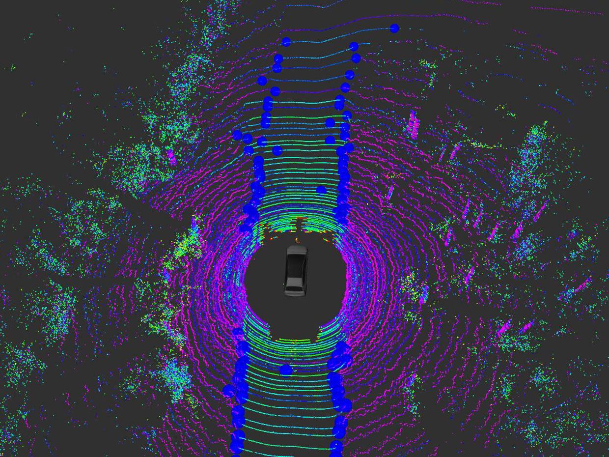
Reason: The system doesn’t need accurate measurements to the curb, the lane markings, and roadside features like sidewalks, trees, and buildings. Instead, it merely consults a very minimalist map, then uses its sensors to see its way to a point up ahead, a “waypoint” that the system chooses for being in the general direction of the ultimate goal. That is, the system does pretty much what a human driver would do when feeling his way forward in an unfamiliar place.
So far, the MIT system, called MapLite, has been tested only on country roads in Massachusetts. There is still work to be done to adapt it to handling multiple lanes, the possibility of U-turns, and other sophisticated rules of the road.
“But this can work in general enviroments,” says Prof. Daniela Rus, who heads the laboratory. “It’s a general approach to building drive-by-wire autonomous systems that do not depend on dense feature maps.”
The researchers tested the system on a Toyota Prius modified to include lidar and other sensors. The project is backed by the Toyota Research Institute.

Photo: MIT CSAIL
Attitudes to mapping vary widely. Some groups have doubled down on mapping detail by using ground-based relays to augment GPS data, say by letting the car know precisely how far away a given point beside the road may be. Others have tried to free themselves from the tyranny of mapping by using machine learning to apply lessons gained from one road to the problems posed by another road.
What makes their approach different, the MIT people say, is that they don’t rely solely on machine learning based on neural networks. Such networks constitute black boxes, the inner workings of which can only be guessed at and can’t be refined by hand.
“We do use machine learning to find what road it is,” Ort says. “But our path finding is all from a model-based approach. If it doesn’t work as we thought, we can go in and fix it.”
Okay, but every technical innovation has its drawbacks. What’s the drawback here?
“The main conceptual drawback is verification,” Ort says. “A detailed map means someone’s driven over it, done a fair amount of testing and shown that it’s safe—it hasn’t changed. But if you’ve never driven over it before, that’s not so. We’re working on how to verify the safety of driving on a road we’ve never seen before.”
