
Data: The route from a blank map to a live map
Innovations for builders, drivers, and everyone else — powered by everyone, anonymously
![]() MapboxBlockedUnblockFollowFollowingJun 5
MapboxBlockedUnblockFollowFollowingJun 5
By: Margaret Lee
What is thought to be the oldest map in existence is a mammoth tusk dated to 25,000 B.C., carved with representations of mountains, rivers, and routes in today’s Czech Republic. For tens of thousands of years, people used maps to reveal the world around us — where we’ve been and where we’re going, connecting and providing context around the points of our lives.
And for virtually all of that geologic time, maps have been the same: a static, top-down view, created by a single person or specialist, representing one layer of primary information. The last 20 years radically altered what’s possible with a map, and today we’re entering a new reality for what maps can do, how we can use them, and the speed at which they can accurately reflect the world around us.
The reason is data: Our ability to collect it from many sources, to process it, and to project vast quantities of data points, in accurate geospatial context, in real-time. The data is the map. Not just what we see, but what we don’t see, the layers of information that run invisibly beneath it. A lack of data — literally a blank map — is at the roots of the founding of Mapbox. You can’t map and analyze election returns in Afghanistan when there is no digital map of Afghanistan. We had to build the map, which meant we had to learn how to build the data.
The era of distributed, connected sensors changed how map data can be created. Mobile phones put the ability to update maps and everything on it into the hands of the average person. But Mapbox doesn’t make phones and operating systems. How did we grow from a team of scrappy dreamers making tools for web maps in a D.C. alley garage to a global company whose platform is touched by more than half a billion people around the world every month?
Unlike other platform providers, we did it by letting builders build how they wanted, customizing their maps and tools for their applications, and letting their users and data stay theirs — not collecting any personally identifiable information as we built our map. We only use anonymized information, and we only use it to make a better map for our builders. This virtuous cycle resulted in explosive growth of users, and of data.
Today, I’m incredibly excited to be taking the next step in this democratization of mapping with the launch of Mapbox Data Services, providing those solving big problems with more ways to access the high-value data sets that build the Mapbox map.
“The wave of adoption of Mapbox tools has been unprecedented, and has given Mapbox a unique capability for massive, decentralized data collection. By making Mapbox Data data commercially available, we expect Mapbox to power important use cases such as on-demand delivery and massive route planning, where their 300 million miles of daily data gives them an important competitive advantage.”— Brent Iadarola, VP, Mobile & Wireless Communications Frost & Sullivan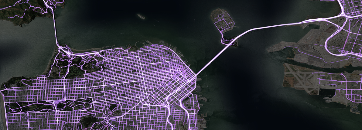
Data is The Map. The Map is The Data.
The Data Services team at Mapbox is responsible for all the data that builds our maps and location tools. Today, those tools are powered by 130 different sources and we’re at a significant inflection point for the types of data we’re able to make available to developers, and the speed at which that data can be ingested, processed and reflected on the map.
Today’s map shows an ever-increasing amount of information: road signs, buildings, points of interest, public transportation, live traffic congestion. And each of these information sources changes in various ways. New buildings may appear on a map on a monthly, weekly or daily cadence, depending on the geographic areas covers. Traffic changes constantly. The collective data set across this information is now considered “the map.”
With these myriad inputs, the Map has changed from pictures to visualizations. Pictures focus on aesthetics, readability, and viewer pleasure. Visualizations are deeper. Visualizations are backed by large volumes of data. Visualizations are dynamic. Visualizations invite seeing the data in different ways. Mapbox’s rendering technologies decouple the rendering aesthetic choice of maps with ever increasing and changing data underneath.
The map is alive
The digitization of location data began in the 1960s, with the first electronic display of administrative boundaries, roads, and satellite images. What was once a costly and slow process of updating road maps is evolving — rapidly. Leveraging crowdsourcing, automated updates, and validations, what was a 5-year update process can be done every six months by legacy mapping companies — and every 7 days for Mapbox’s map. Traffic data is updated every 5 minutes.
At this speed of data, the map is no longer static. It’s living, and far more detailed. The ability to gather, process, harmonize and visualize a variety of data in new ways unlocks data that was previously locked in niche domain-specific repositories, or simply was not available.
Enriching the map
The distributed approach opens of new sources of data, including data that seems like it should be readily available, but may not be. Street sign data, such as speed limits, and traffic data are good examples. Street signs are a surprisingly diverse data set whose administration can spread across federal, state, and local government agencies. As a result, even in countries like the United States, there is no definitive speed limits and street signs data set available. Data gathering on a meaningful scale is a challenge. Some vendors take the approach of street-level image gathering, with a limited fleet of HD camera-equipped vehicles. To cover even a small percentage of the roads is neither scalable nor does it makes economic sense.
A new approach is needed. At Mapbox, our Vision SDK takes a crowdsourcing approach, putting the ability to capture and recognize road features and changes in the hands of hundreds of thousands of developers, and millions of mobile phone users. We will soon be making available to our customers a speed limits data product for the United States and Europe.
The view has changed
Data is also changing our perspective of the map itself. From ancient times through the launch of Google Earth, maps were mostly birds-eye view, of varying degrees of resolution. With ground level capturing, and vision and augmented reality technologies poised to break into the mainstream, mapping the world around us, in increasing granular detail, in 3D, as seen through our eyes, becomes possible. From the ground level, mapping data goes beyond longitude and latitude data. 3D elements such as road texture, curvature, buildings, all types of vehicles, pedestrians, vegetation, all become inputs to the semantic map.
A better map powered by everyone — anonymously
For centuries, maps were created by specialist cartographers. Even in recent history, map updates are done by specially trained surveyors and traffic information is collected by specialized road sensor equipment. But the best person to tell you what’s happening in a neighborhood is the person living there, and the best person to give you traffic information is the one driving on that road. The distribution of mobile phones and sensors has unlocked crowd based mapping and live traffic collection that are powerful because of their scale.
There are only a few companies on the planet that are able to harness that power and leverage it to build a high-quality living map. We strip all individual information from the data we gather and share only derivative, anonymous datasets. This allows us to empower builders on the Mapbox platform with data of incredible scale without putting anyone’s privacy at risk.
Access for however you build
The map of the future is a real-time aggregation of data, displayed in a variety of different ways depending on the use case, and spanning across multiple layers, all determined by the design and desire of the developers and the users. Through big data ingestion and processing, applying computer vision and neural network technologies, pushing data to learning algorithms designed by data scientists, Mapbox is redefining the map, and redefining the data available for developers and industries building with location and maps.
Mapbox Data Services adds a new way for builders and enterprise to access high-value data to add to any map, platform or intelligence solution. See the premium data offerings at mapbox.com/data-products and reach out to our team to talk about building with Mapbox data.
Margaret Lee – General Manager, Data Services – Mapbox | LinkedInJoin LinkedIn Margaret is General Manager for Data Services at Mapbox, an innovative platform for mapping and…www.linkedin.com
Go to Source